Geospatial needs of fire agencies
 The activities and responsibilities of fire agencies are extensive. If a web map is to be effective in meeting fire agency needs, it must first integrate well with existing frameworks for management and deployment of personnel and resources. To accomplish this, the map design process must engage to the greatest extent feasible the full range of prospective users.
The ENPLAN web map platform, MapPort, can support a wide array of fire agency activities, and be used to capture, store, manipulate, analyze, manage, and present all types of geographical data relevant to those activities. In this application, the distribution capacity of MapPort is crucially effective given the distributed nature of fire agency activities.
Here in skeleton form are some of the basic questions to be asked by agencies in designing maps to run on MapPort. As can be seen, the diversity and depth of relevant geographical data is enormous. Therefore, the datasets to be incorporated and activities practical must be prioritized in any given implementation, and the principle of Minimum Viable Product applied at all stages.
- In what categories of activity do we engage?
- Structure fire response
-
- Suppression
- Rescue
-
- Wildfire response
-
- Preplanning for large incidents
- Evacuation planning
- Critical infrastructure protection
-
- Fire Inquiry
-
- Origin analysis
- Arson investigation
-
- Prevention
-
- Burn restriction enforcement
- Violation prosecution and case documentation
- Public fire safety education
-
- Other emergency management
- Disaster relief management
- Community outreach
- What maps or map system do we use or have now?
- Property maps online
- Google Maps
- Hard copy map books
- CAL FIRE operations maps
- Other?
- What information is needed or being sought in maps?
- Land division
-
- Property owner
- Responsible entity
- PLSS
-
- Strategic conditions/feeds
-
- NASA hotspot detections
- GeoMAC Perimeters
- Wind speed and direction
- Topography
- Humidity
-
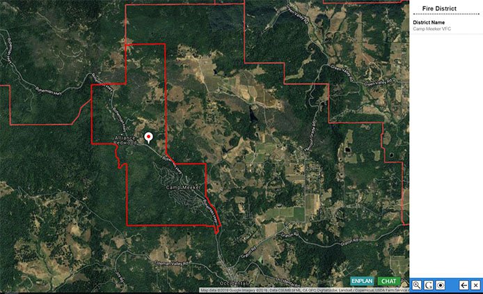
- District/agency service area
-
- Boundary
- Administrative subdivisions
- Adjacent districts/agency service areas
- Responsibility assignments by area
- Local responsibility
- CAL FIRE responsibility
- Federal responsibility
- Direct Protection Areas
-
- Municipal boundaries
-
- Counties
- Cities
- Water districts
- Community services districts
-
- Agency facilities and resources
-
- Stations
- Equipment
- Personnel/volunteers
-
- Pre-incident survey/evaluation/management
-
- Fire insurance risk zones
- Fuels management areas/zones
- Response time analysis/heat map
-
- Water sources
-
- Hydrant locations
- Type
- PSI
- Surface water impoundments/sources
- Accessible by vehicle
- Helicopter dip sites
- Hydrant locations
-
- Emergency vehicle routing/access
-
- Street maps
- Jeep/logging trails
- Bridge bearing capacities
-
- Evacuation plans
- Critical infrastructure systems
-
- Utilities
- Power
- Water
-
- Hazards
-
- Code violation sites unabated
- Flammables
- Toxics
- Vegetation fire hazard severity
-
- Post-Incident assessment/evaluation
-
- Fire incident locations
- Historic wildfire perimeters
- Type
- Damage assessment
-